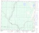
Maps showing Calling River, 30-70-19-W4, Alberta
Calling River is a Unincorporated area located in 30-70-19-W4, Alberta and has an elevation of 512 meters.
- Latitude: 55° 5' 34'' North (decimal: 55.0927778)
- Longitude: 112° 53' 1'' West (decimal: -112.8836110)
- Topography Feature Category: Unincorporated area
- Geographical Feature: Locality
- Canadian Province/Territory: Alberta
- Elevation: 512 meters
- Location: 30-70-19-W4
- Atlas of Canada Locator Map: Calling River
- GPS Coordinate Locator Map: Calling River Lat/Long
Calling River NTS Map Sheets