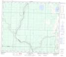
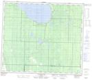
Maps showing Calling River, 30-70-19-W4, Alberta
Calling River is a River located in 30-70-19-W4, Alberta and has an elevation of 525 meters.
- Latitude: 55° 5' 24'' North (decimal: 55.0900830)
- Longitude: 112° 52' 57'' West (decimal: -112.8825279)
- Topography Feature Category: River
- Geographical Feature: River
- Canadian Province/Territory: Alberta
- Elevation: 525 meters
- Location: 30-70-19-W4
- Atlas of Canada Locator Map: Calling River
- GPS Coordinate Locator Map: Calling River Lat/Long
Calling River NTS Map Sheets