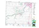
Maps showing Calmar, 25-49-27-W4, Alberta
Calmar is a Town located in 25-49-27-W4, Alberta and has an elevation of 727 meters.
- Latitude: 53° 15' 28'' North (decimal: 53.2577777)
- Longitude: 113° 48' 39'' West (decimal: -113.8108333)
- Topography Feature Category: Town
- Geographical Feature: Town
- Canadian Province/Territory: Alberta
- Elevation: 727 meters
- Location: 25-49-27-W4
- Atlas of Canada Locator Map: Calmar
- GPS Coordinate Locator Map: Calmar Lat/Long