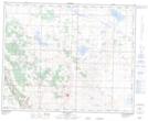
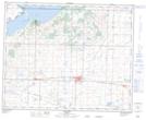
Maps showing Cameron Lake, 38-19-W4, Alberta
Cameron Lake is a Lake located in 38-19-W4, Alberta and has an elevation of 831 meters.
- Latitude: 52° 15' 0'' North (decimal: 52.2500000)
- Longitude: 112° 37' 46'' West (decimal: -112.6294443)
- Topography Feature Category: Lake
- Geographical Feature: Lake
- Canadian Province/Territory: Alberta
- Elevation: 831 meters
- Location: 38-19-W4
- Atlas of Canada Locator Map: Cameron Lake
- GPS Coordinate Locator Map: Cameron Lake Lat/Long
Cameron Lake NTS Map Sheets