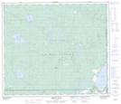
Maps showing Canoe Lake, 69-3-W4, Alberta
Canoe Lake is a Lake located in 69-3-W4, Alberta and has an elevation of 723 meters.
- Latitude: 54° 57' 51'' North (decimal: 54.9641666)
- Longitude: 110° 23' 6'' West (decimal: -110.3850000)
- Topography Feature Category: Lake
- Geographical Feature: Lake
- Canadian Province/Territory: Alberta
- Elevation: 723 meters
- Location: 69-3-W4
- Atlas of Canada Locator Map: Canoe Lake
- GPS Coordinate Locator Map: Canoe Lake Lat/Long
Canoe Lake NTS Map Sheets