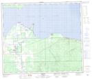
Maps showing Canyon Creek, 36-73-8-W5, Alberta
Canyon Creek is a Unincorporated area located in 36-73-8-W5, Alberta and has an elevation of 585 meters.
- Latitude: 55° 22' 19'' North (decimal: 55.3719444)
- Longitude: 115° 5' 41'' West (decimal: -115.0947221)
- Topography Feature Category: Unincorporated area
- Geographical Feature: Hamlet
- Canadian Province/Territory: Alberta
- Elevation: 585 meters
- Location: 36-73-8-W5
- Atlas of Canada Locator Map: Canyon Creek
- GPS Coordinate Locator Map: Canyon Creek Lat/Long
Canyon Creek NTS Map Sheets