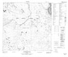
Maps showing Caribou Islands, 123-9-W4, Alberta
Caribou Islands is a Island located in 123-9-W4, Alberta and has an elevation of 188 meters.
- Latitude: 59° 44' 00'' North (decimal: 59.7333333)
- Longitude: 111° 31' 14'' West (decimal: -111.5205556)
- Topography Feature Category: Island
- Geographical Feature: Islands
- Canadian Province/Territory: Alberta
- Elevation: 188 meters
- Location: 123-9-W4
- Atlas of Canada Locator Map: Caribou Islands
- GPS Coordinate Locator Map: Caribou Islands Lat/Long
Caribou Islands NTS Map Sheets