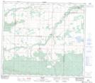
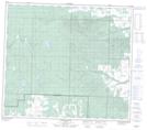
Maps showing Spirit Ridge, 77-6,7-W6, Alberta
Spirit Ridge is a Mountain located in 77-6,7-W6, Alberta and has an elevation of 881 meters.
- Latitude: 55° 40' 20'' North (decimal: 55.6722222)
- Longitude: 119° 0' 36'' West (decimal: -119.0100000)
- Topography Feature Category: Mountain
- Geographical Feature: Ridge
- Canadian Province/Territory: Alberta
- Elevation: 881 meters
- Location: 77-6,7-W6
- Atlas of Canada Locator Map: Spirit Ridge
- GPS Coordinate Locator Map: Spirit Ridge Lat/Long
Spirit Ridge NTS Map Sheets