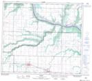
Maps showing Spirit River, 22-78-6-W6, Alberta
Spirit River is a Town located in 22-78-6-W6, Alberta and has an elevation of 640 meters.
- Latitude: 55° 46' 43'' North (decimal: 55.7786111)
- Longitude: 118° 50' 12'' West (decimal: -118.8366667)
- Topography Feature Category: Town
- Geographical Feature: Town
- Canadian Province/Territory: Alberta
- Elevation: 640 meters
- Location: 22-78-6-W6
- Atlas of Canada Locator Map: Spirit River
- GPS Coordinate Locator Map: Spirit River Lat/Long
Spirit River NTS Map Sheets