Maps showing Spray Lakes Reservoir, 22,23-10,11-W5, Alberta
Spray Lakes Reservoir is a Lake located in 22,23-10,11-W5, Alberta and has an elevation of 1718 meters.
- Latitude: 50° 54' 42'' North (decimal: 50.9116666)
- Longitude: 115° 20' 22'' West (decimal: -115.3394443)
- Topography Feature Category: Lake
- Geographical Feature: Reservoir
- Canadian Province/Territory: Alberta
- Elevation: 1718 meters
- Location: 22,23-10,11-W5
- Atlas of Canada Locator Map: Spray Lakes Reservoir
- GPS Coordinate Locator Map: Spray Lakes Reservoir Lat/Long
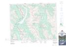
Spray Lakes Reservoir NTS Map Sheets