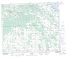
Maps showing Springdale, 35-44-2-W5, Alberta
Springdale is a Unincorporated area located in 35-44-2-W5, Alberta and has an elevation of 919 meters.
- Latitude: 52° 49' 56'' North (decimal: 52.8322221)
- Longitude: 114° 11' 39'' West (decimal: -114.1941667)
- Topography Feature Category: Unincorporated area
- Geographical Feature: Locality
- Canadian Province/Territory: Alberta
- Elevation: 919 meters
- Location: 35-44-2-W5
- Atlas of Canada Locator Map: Springdale
- GPS Coordinate Locator Map: Springdale Lat/Long
Springdale NTS Map Sheets