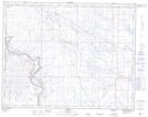
Maps showing Spring Hill Canal, 20-16-17-W4, Alberta
Spring Hill Canal is a River located in 20-16-17-W4, Alberta and has an elevation of 775 meters.
- Latitude: 50° 41' 1'' North (decimal: 50.6836110)
- Longitude: 112° 11' 35'' West (decimal: -112.1930555)
- Topography Feature Category: River
- Geographical Feature: Canal
- Canadian Province/Territory: Alberta
- Elevation: 775 meters
- Location: 20-16-17-W4
- Atlas of Canada Locator Map: Spring Hill Canal
- GPS Coordinate Locator Map: Spring Hill Canal Lat/Long