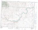
Maps showing Spring Point, 10-9-29-W4, Alberta
Spring Point is a Unincorporated area located in 10-9-29-W4, Alberta and has an elevation of 1262 meters.
- Latitude: 49° 43' 2'' North (decimal: 49.7171390)
- Longitude: 113° 51' 46'' West (decimal: -113.8628330)
- Topography Feature Category: Unincorporated area
- Geographical Feature: Locality
- Canadian Province/Territory: Alberta
- Elevation: 1262 meters
- Location: 10-9-29-W4
- Atlas of Canada Locator Map: Spring Point
- GPS Coordinate Locator Map: Spring Point Lat/Long