Maps showing Squaw Coulée, 32-13-1-W5, Alberta
Squaw Coulée is a Valley located in 32-13-1-W5, Alberta and has an elevation of 1495 meters.
- Latitude: 50° 8' North (decimal: 50.1333000)
- Longitude: 114° 7' West (decimal: -114.1166999)
- Topography Feature Category: Valley
- Geographical Feature: Coulée
- Canadian Province/Territory: Alberta
- Elevation: 1495 meters
- Location: 32-13-1-W5
- Atlas of Canada Locator Map: Squaw Coulée
- GPS Coordinate Locator Map: Squaw Coulée Lat/Long
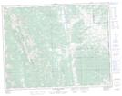
Squaw Coulée NTS Map Sheets