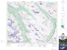
Maps showing Stanley Falls, 39-24-W5, Alberta
Stanley Falls is a Falls located in 39-24-W5, Alberta and has an elevation of 1643 meters.
- Latitude: 52° 19' 21'' North (decimal: 52.3224999)
- Longitude: 117° 19' 26'' West (decimal: -117.3238889)
- Topography Feature Category: Falls
- Geographical Feature: Falls
- Canadian Province/Territory: Alberta
- Elevation: 1643 meters
- Location: 39-24-W5
- Atlas of Canada Locator Map: Stanley Falls
- GPS Coordinate Locator Map: Stanley Falls Lat/Long
Stanley Falls NTS Map Sheets