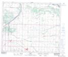
Maps showing Star, 9-56-19-W4, Alberta
Star is a Unincorporated area located in 9-56-19-W4, Alberta and has an elevation of 626 meters.
- Latitude: 53° 49' 11'' North (decimal: 53.8197222)
- Longitude: 112° 46' 32'' West (decimal: -112.7755556)
- Topography Feature Category: Unincorporated area
- Geographical Feature: Locality
- Canadian Province/Territory: Alberta
- Elevation: 626 meters
- Location: 9-56-19-W4
- Atlas of Canada Locator Map: Star
- GPS Coordinate Locator Map: Star Lat/Long