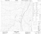
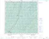
Maps showing Steen River, 15-122-19-W5, Alberta
Steen River is a Unincorporated area located in 15-122-19-W5, Alberta and has an elevation of 299 meters.
- Latitude: 59° 37' 39'' North (decimal: 59.6274999)
- Longitude: 117° 10' 2'' West (decimal: -117.1672221)
- Topography Feature Category: Unincorporated area
- Geographical Feature: Hamlet
- Canadian Province/Territory: Alberta
- Elevation: 299 meters
- Location: 15-122-19-W5
- Atlas of Canada Locator Map: Steen River
- GPS Coordinate Locator Map: Steen River Lat/Long
Steen River NTS Map Sheets