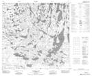
Maps showing Hooker Lake, 121-5,6-W4, Alberta
Hooker Lake is a Lake located in 121-5,6-W4, Alberta and has an elevation of 293 meters.
- Latitude: 59° 33' 13'' North (decimal: 59.5536110)
- Longitude: 110° 51' 37'' West (decimal: -110.8602778)
- Topography Feature Category: Lake
- Geographical Feature: Lake
- Canadian Province/Territory: Alberta
- Elevation: 293 meters
- Location: 121-5,6-W4
- Atlas of Canada Locator Map: Hooker Lake
- GPS Coordinate Locator Map: Hooker Lake Lat/Long
Hooker Lake NTS Map Sheets