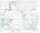
Maps showing Hope Valley, 19-46-4-W4, Alberta
Hope Valley is a Unincorporated area located in 19-46-4-W4, Alberta and has an elevation of 681 meters.
- Latitude: 52° 58' North (decimal: 52.9667000)
- Longitude: 110° 35' West (decimal: -110.5832999)
- Topography Feature Category: Unincorporated area
- Geographical Feature: Locality
- Canadian Province/Territory: Alberta
- Elevation: 681 meters
- Location: 19-46-4-W4
- Atlas of Canada Locator Map: Hope Valley
- GPS Coordinate Locator Map: Hope Valley Lat/Long
Hope Valley NTS Map Sheets