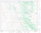
Maps showing Houcher Lake, 39-6-W4, Alberta
Houcher Lake is a Lake located in 39-6-W4, Alberta and has an elevation of 676 meters.
- Latitude: 52° 24' 39'' North (decimal: 52.4108333)
- Longitude: 110° 50' 32'' West (decimal: -110.8422222)
- Topography Feature Category: Lake
- Geographical Feature: Lake
- Canadian Province/Territory: Alberta
- Elevation: 676 meters
- Location: 39-6-W4
- Atlas of Canada Locator Map: Houcher Lake
- GPS Coordinate Locator Map: Houcher Lake Lat/Long