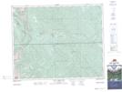
Maps showing Hunter Valley, 31-9-W5, Alberta
Hunter Valley is a Valley located in 31-9-W5, Alberta and has an elevation of 1431 meters.
- Latitude: 51° 39' 10'' North (decimal: 51.6527777)
- Longitude: 115° 15' 25'' West (decimal: -115.2569443)
- Topography Feature Category: Valley
- Geographical Feature: Valley
- Canadian Province/Territory: Alberta
- Elevation: 1431 meters
- Location: 31-9-W5
- Atlas of Canada Locator Map: Hunter Valley
- GPS Coordinate Locator Map: Hunter Valley Lat/Long
Hunter Valley NTS Map Sheets