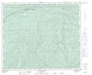
Maps showing Hurdy, 30-60-14-W5, Alberta
Hurdy is a Unincorporated area located in 30-60-14-W5, Alberta.
- Latitude: 54° 12' 45'' North (decimal: 54.2125000)
- Longitude: 116° 5' 56'' West (decimal: -116.0988889)
- Topography Feature Category: Unincorporated area
- Geographical Feature: Railway Point
- Canadian Province/Territory: Alberta
- Location: 30-60-14-W5
- Atlas of Canada Locator Map: Hurdy
- GPS Coordinate Locator Map: Hurdy Lat/Long
Hurdy NTS Map Sheets