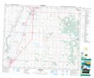
Maps showing Innisfail, 21-35-28-W4, Alberta
Innisfail is a Town located in 21-35-28-W4, Alberta and has an elevation of 956 meters.
- Latitude: 52° 1' 41'' North (decimal: 52.0281390)
- Longitude: 113° 57' 2'' West (decimal: -113.9506390)
- Topography Feature Category: Town
- Geographical Feature: Town
- Canadian Province/Territory: Alberta
- Elevation: 956 meters
- Location: 21-35-28-W4
- Atlas of Canada Locator Map: Innisfail
- GPS Coordinate Locator Map: Innisfail Lat/Long