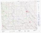
Maps showing Carstairs, 17-30-1-W5, Alberta
Carstairs is a Town located in 17-30-1-W5, Alberta and has an elevation of 1058 meters.
- Latitude: 51° 33' 56'' North (decimal: 51.5655555)
- Longitude: 114° 5' 58'' West (decimal: -114.0994443)
- Topography Feature Category: Town
- Geographical Feature: Town
- Canadian Province/Territory: Alberta
- Elevation: 1058 meters
- Location: 17-30-1-W5
- Atlas of Canada Locator Map: Carstairs
- GPS Coordinate Locator Map: Carstairs Lat/Long