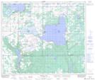
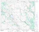
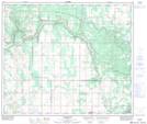
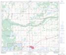
Maps showing Moose Lake, 60,61-6,7-W4, Alberta
Moose Lake is a Lake located in 60,61-6,7-W4, Alberta and has an elevation of 537 meters.
- Latitude: 54° 15' 4'' North (decimal: 54.2511110)
- Longitude: 110° 54' 25'' West (decimal: -110.9069444)
- Topography Feature Category: Lake
- Geographical Feature: Lake
- Canadian Province/Territory: Alberta
- Elevation: 537 meters
- Location: 60,61-6,7-W4
- Atlas of Canada Locator Map: Moose Lake
- GPS Coordinate Locator Map: Moose Lake Lat/Long
Moose Lake NTS Map Sheets