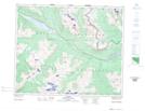
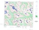
Maps showing Mount Moren, 46-4-W6, Alberta
Mount Moren is a Mountain located in 46-4-W6, Alberta and has an elevation of 2257 meters.
- Latitude: 53° 0' 25'' North (decimal: 53.0069444)
- Longitude: 118° 34' 18'' West (decimal: -118.5716667)
- Topography Feature Category: Mountain
- Geographical Feature: Mount
- Canadian Province/Territory: Alberta
- Elevation: 2257 meters
- Location: 46-4-W6
- Atlas of Canada Locator Map: Mount Moren
- GPS Coordinate Locator Map: Mount Moren Lat/Long
Mount Moren NTS Map Sheets