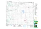
Maps showing Morinville, 55,56-25-W4, Alberta
Morinville is a Town located in 55,56-25-W4, Alberta and has an elevation of 700 meters.
- Latitude: 53° 48' 10'' North (decimal: 53.8027777)
- Longitude: 113° 38' 38'' West (decimal: -113.6438889)
- Topography Feature Category: Town
- Geographical Feature: Town
- Canadian Province/Territory: Alberta
- Elevation: 700 meters
- Location: 55,56-25-W4
- Atlas of Canada Locator Map: Morinville
- GPS Coordinate Locator Map: Morinville Lat/Long
Morinville NTS Map Sheets