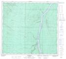
Maps showing Morrison Island, 97-10-W4, Alberta
Morrison Island is a Island located in 97-10-W4, Alberta and has an elevation of 236 meters.
- Latitude: 57° 27' 26'' North (decimal: 57.4572222)
- Longitude: 111° 36' 24'' West (decimal: -111.6066666)
- Topography Feature Category: Island
- Geographical Feature: Island
- Canadian Province/Territory: Alberta
- Elevation: 236 meters
- Location: 97-10-W4
- Atlas of Canada Locator Map: Morrison Island
- GPS Coordinate Locator Map: Morrison Island Lat/Long
Morrison Island NTS Map Sheets