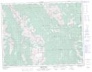
Maps showing Mosquito Hill, 30-15-5-W5, Alberta
Mosquito Hill is a Mountain located in 30-15-5-W5, Alberta.
- Latitude: 50° 17' 20'' North (decimal: 50.2888889)
- Longitude: 114° 40' 49'' West (decimal: -114.6802778)
- Topography Feature Category: Mountain
- Geographical Feature: Hill
- Canadian Province/Territory: Alberta
- Location: 30-15-5-W5
- Atlas of Canada Locator Map: Mosquito Hill
- GPS Coordinate Locator Map: Mosquito Hill Lat/Long
Mosquito Hill NTS Map Sheets