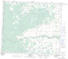
Maps showing Mount Valley, 24-70-13-W6, Alberta
Mount Valley is a Unincorporated area located in 24-70-13-W6, Alberta and has an elevation of 799 meters.
- Latitude: 55° 5' 1'' North (decimal: 55.0836111)
- Longitude: 119° 50' 43'' West (decimal: -119.8452777)
- Topography Feature Category: Unincorporated area
- Geographical Feature: Locality
- Canadian Province/Territory: Alberta
- Elevation: 799 meters
- Location: 24-70-13-W6
- Atlas of Canada Locator Map: Mount Valley
- GPS Coordinate Locator Map: Mount Valley Lat/Long
Mount Valley NTS Map Sheets