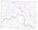
Maps showing Carseland, 7-22-25-W4, Alberta
Carseland is a Unincorporated area located in 7-22-25-W4, Alberta and has an elevation of 964 meters.
- Latitude: 50° 51' 5'' North (decimal: 50.8513888)
- Longitude: 113° 28' 4'' West (decimal: -113.4677777)
- Topography Feature Category: Unincorporated area
- Geographical Feature: Hamlet
- Canadian Province/Territory: Alberta
- Elevation: 964 meters
- Location: 7-22-25-W4
- Atlas of Canada Locator Map: Carseland
- GPS Coordinate Locator Map: Carseland Lat/Long