Canada Topographic Maps

Castle River Topo Maps

Topography maps and Latitude/Longitude Location

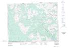
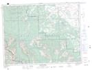
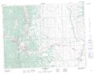
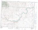
Maps showing Castle River, 27-7-30-W4, Alberta

Castle River is a River located in 27-7-30-W4, Alberta and has an elevation of 1440 meters.

  • Latitude: 49° 35' 38'' North   (decimal: 49.5938889)
  • Longitude: 113° 59' 42'' West   (decimal: -113.9949999)
  • Topography Feature Category: River
  • Geographical Feature: River
  • Canadian Province/Territory: Alberta
  • Elevation: 1440 meters
  • Location: 27-7-30-W4
  • Atlas of Canada Locator Map: Castle River
  • GPS Coordinate Locator Map: Castle River Lat/Long

Castle River NTS Map Sheets

082G01 Sage Creek Topographic Map at 1:50,000 scale

082G08 Beaver Mines Topographic Map at 1:50,000 scale

082G09 Blairmore Topographic Map at 1:50,000 scale

082H12 Brocket Topographic Map at 1:50,000 scale

082G Fernie Topographic Map at 1:250,000 scale

082H Lethbridge Topographic Map at 1:250,000 scale

 
Buy Topographic Maps DVD
Newsletter Sign-up

Yes, I want to receive map store discounts.


Bookmark and Share