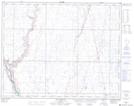
Maps showing Cessford, 36-23-12-W4, Alberta
Cessford is a Unincorporated area located in 36-23-12-W4, Alberta and has an elevation of 710 meters.
- Latitude: 51° 0' 23'' North (decimal: 51.0063888)
- Longitude: 111° 33' 24'' West (decimal: -111.5566667)
- Topography Feature Category: Unincorporated area
- Geographical Feature: Hamlet
- Canadian Province/Territory: Alberta
- Elevation: 710 meters
- Location: 36-23-12-W4
- Atlas of Canada Locator Map: Cessford
- GPS Coordinate Locator Map: Cessford Lat/Long