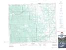
Maps showing Charlton Muskeg, 11-30-6-W5, Alberta
Charlton Muskeg is a Low vegetation located in 11-30-6-W5, Alberta and has an elevation of 1325 meters.
- Latitude: 51° 33' 30'' North (decimal: 51.5583333)
- Longitude: 114° 44' 3'' West (decimal: -114.7341666)
- Topography Feature Category: Low vegetation
- Geographical Feature: Muskeg
- Canadian Province/Territory: Alberta
- Elevation: 1325 meters
- Location: 11-30-6-W5
- Atlas of Canada Locator Map: Charlton Muskeg
- GPS Coordinate Locator Map: Charlton Muskeg Lat/Long
Charlton Muskeg NTS Map Sheets