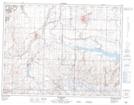
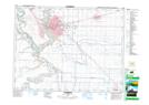
Maps showing Stirling, 29-6-19-W4, Alberta
Stirling is a Village located in 29-6-19-W4, Alberta and has an elevation of 935 meters.
- Latitude: 49° 29' 49'' North (decimal: 49.4969444)
- Longitude: 112° 30' 47'' West (decimal: -112.5130556)
- Topography Feature Category: Village
- Geographical Feature: Village
- Canadian Province/Territory: Alberta
- Elevation: 935 meters
- Location: 29-6-19-W4
- Atlas of Canada Locator Map: Stirling
- GPS Coordinate Locator Map: Stirling Lat/Long
Stirling NTS Map Sheets