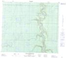
Maps showing Stony Rapids, 31-79-17-W4, Alberta
Stony Rapids is a Rapids located in 31-79-17-W4, Alberta and has an elevation of 444 meters.
- Latitude: 55° 53' 13'' North (decimal: 55.8869444)
- Longitude: 112° 38' 59'' West (decimal: -112.6497222)
- Topography Feature Category: Rapids
- Geographical Feature: Rapids
- Canadian Province/Territory: Alberta
- Elevation: 444 meters
- Location: 31-79-17-W4
- Atlas of Canada Locator Map: Stony Rapids
- GPS Coordinate Locator Map: Stony Rapids Lat/Long
Stony Rapids NTS Map Sheets