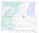
Maps showing Stove Lake, 50-20-W4, Alberta
Stove Lake is a Lake located in 50-20-W4, Alberta and has an elevation of 763 meters.
- Latitude: 53° 20' 5'' North (decimal: 53.3347222)
- Longitude: 112° 55' 13'' West (decimal: -112.9202778)
- Topography Feature Category: Lake
- Geographical Feature: Lake
- Canadian Province/Territory: Alberta
- Elevation: 763 meters
- Location: 50-20-W4
- Atlas of Canada Locator Map: Stove Lake
- GPS Coordinate Locator Map: Stove Lake Lat/Long