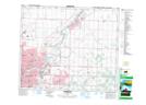
Maps showing County of Strathcona No. 20, Alberta
County of Strathcona No. 20 is a Major municipal/district area - major agglomeration located in Alberta.
- Latitude: 53° 35' 8'' North (decimal: 53.5856000)
- Longitude: 113° 5' 53'' West (decimal: -113.0981000)
- Topography Feature Category: Major municipal/district area - major agglomeration
- Geographical Feature: County
- Canadian Province/Territory: Alberta
- GPS Coordinate Locator Map: County of Strathcona No. 20 Lat/Long