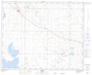
Maps showing Sullivan Lake, 18-35-13-W4, Alberta
Sullivan Lake is a Unincorporated area located in 18-35-13-W4, Alberta and has an elevation of 813 meters.
- Latitude: 52° 0' 14'' North (decimal: 52.0038889)
- Longitude: 111° 51' 37'' West (decimal: -111.8602777)
- Topography Feature Category: Unincorporated area
- Geographical Feature: Locality
- Canadian Province/Territory: Alberta
- Elevation: 813 meters
- Location: 18-35-13-W4
- Atlas of Canada Locator Map: Sullivan Lake
- GPS Coordinate Locator Map: Sullivan Lake Lat/Long