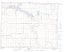
Maps showing Sundial Butte, 13-21-W4, Alberta
Sundial Butte is a Mountain located in 13-21-W4, Alberta and has an elevation of 928 meters.
- Latitude: 50° 7' 33'' North (decimal: 50.1258333)
- Longitude: 112° 45' 11'' West (decimal: -112.7530555)
- Topography Feature Category: Mountain
- Geographical Feature: Butte
- Canadian Province/Territory: Alberta
- Elevation: 928 meters
- Location: 13-21-W4
- Atlas of Canada Locator Map: Sundial Butte
- GPS Coordinate Locator Map: Sundial Butte Lat/Long