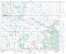
Maps showing Irma, 27-45-9-W4, Alberta
Irma is a Village located in 27-45-9-W4, Alberta and has an elevation of 685 meters.
- Latitude: 52° 54' 43'' North (decimal: 52.9119444)
- Longitude: 111° 13' 42'' West (decimal: -111.2283333)
- Topography Feature Category: Village
- Geographical Feature: Village
- Canadian Province/Territory: Alberta
- Elevation: 685 meters
- Location: 27-45-9-W4
- Atlas of Canada Locator Map: Irma
- GPS Coordinate Locator Map: Irma Lat/Long