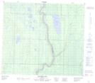
Maps showing Iron Point, 5-75-18-W4, Alberta
Iron Point is a Cape located in 5-75-18-W4, Alberta and has an elevation of 547 meters.
- Latitude: 55° 28' 16'' North (decimal: 55.4711111)
- Longitude: 112° 46' 27'' West (decimal: -112.7741667)
- Topography Feature Category: Cape
- Geographical Feature: Point
- Canadian Province/Territory: Alberta
- Elevation: 547 meters
- Location: 5-75-18-W4
- Atlas of Canada Locator Map: Iron Point
- GPS Coordinate Locator Map: Iron Point Lat/Long
Iron Point NTS Map Sheets