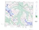
Maps showing Jackpine Pass, 50-10-W6, Alberta
Jackpine Pass is a Valley located in 50-10-W6, Alberta and has an elevation of 2086 meters.
- Latitude: 53° 21' 31'' North (decimal: 53.3586110)
- Longitude: 119° 25' 51'' West (decimal: -119.4308333)
- Topography Feature Category: Valley
- Geographical Feature: Pass
- Canadian Province/Territory: Alberta
- Elevation: 2086 meters
- Location: 50-10-W6
- Atlas of Canada Locator Map: Jackpine Pass
- GPS Coordinate Locator Map: Jackpine Pass Lat/Long
Jackpine Pass NTS Map Sheets