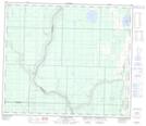
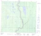
Maps showing La Petite Rivière Jaillante, 35-71-19-W4, Alberta
La Petite Rivière Jaillante is a River located in 35-71-19-W4, Alberta and has an elevation of 602 meters.
- Latitude: 55° 11' 19'' North (decimal: 55.1885559)
- Longitude: 112° 49' 13'' West (decimal: -112.8201670)
- Topography Feature Category: River
- Geographical Feature: Rivière
- Canadian Province/Territory: Alberta
- Elevation: 602 meters
- Location: 35-71-19-W4
- Atlas of Canada Locator Map: La Petite Rivière Jaillante
- GPS Coordinate Locator Map: La Petite Rivière Jaillante Lat/Long
La Petite Rivière Jaillante NTS Map Sheets