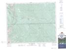
Maps showing James Pass, 32-11-W5, Alberta
James Pass is a Valley located in 32-11-W5, Alberta and has an elevation of 1691 meters.
- Latitude: 51° 43' 47'' North (decimal: 51.7297222)
- Longitude: 115° 26' 45'' West (decimal: -115.4458333)
- Topography Feature Category: Valley
- Geographical Feature: Pass
- Canadian Province/Territory: Alberta
- Elevation: 1691 meters
- Location: 32-11-W5
- Atlas of Canada Locator Map: James Pass
- GPS Coordinate Locator Map: James Pass Lat/Long
James Pass NTS Map Sheets