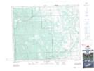
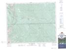
Maps showing Williams Creek, 29-31-7-W5, Alberta
Williams Creek is a River located in 29-31-7-W5, Alberta.
- Latitude: 51° 41' 28'' North (decimal: 51.6911110)
- Longitude: 114° 57' 44'' West (decimal: -114.9622222)
- Topography Feature Category: River
- Geographical Feature: Creek
- Canadian Province/Territory: Alberta
- Location: 29-31-7-W5
- Atlas of Canada Locator Map: Williams Creek
- GPS Coordinate Locator Map: Williams Creek Lat/Long
Williams Creek NTS Map Sheets