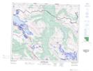
Maps showing Mount Jessie, 50-10-W6, Alberta
Mount Jessie is a Mountain located in 50-10-W6, Alberta and has an elevation of 2385 meters.
- Latitude: 53° 18' 8'' North (decimal: 53.3022222)
- Longitude: 119° 19' 28'' West (decimal: -119.3244444)
- Topography Feature Category: Mountain
- Geographical Feature: Mount
- Canadian Province/Territory: Alberta
- Elevation: 2385 meters
- Location: 50-10-W6
- Atlas of Canada Locator Map: Mount Jessie
- GPS Coordinate Locator Map: Mount Jessie Lat/Long
Mount Jessie NTS Map Sheets