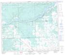
Maps showing Mud Lake, 59-8-W5, Alberta
Mud Lake is a Lake located in 59-8-W5, Alberta and has an elevation of 769 meters.
- Latitude: 54° 8' 48'' North (decimal: 54.1466666)
- Longitude: 115° 3' 42'' West (decimal: -115.0616667)
- Topography Feature Category: Lake
- Geographical Feature: Lake
- Canadian Province/Territory: Alberta
- Elevation: 769 meters
- Location: 59-8-W5
- Atlas of Canada Locator Map: Mud Lake
- GPS Coordinate Locator Map: Mud Lake Lat/Long
Mud Lake NTS Map Sheets