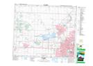
Maps showing Muir Lake, 31,32-53,54-27-W4, Alberta
Muir Lake is a Lake located in 31,32-53,54-27-W4, Alberta and has an elevation of 737 meters.
- Latitude: 53° 37' 29'' North (decimal: 53.6247222)
- Longitude: 113° 57' 30'' West (decimal: -113.9583332)
- Topography Feature Category: Lake
- Geographical Feature: Lake
- Canadian Province/Territory: Alberta
- Elevation: 737 meters
- Location: 31,32-53,54-27-W4
- Atlas of Canada Locator Map: Muir Lake
- GPS Coordinate Locator Map: Muir Lake Lat/Long