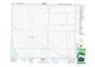
Maps showing Mundare, 19-53-16-W4, Alberta
Mundare is a Town located in 19-53-16-W4, Alberta and has an elevation of 687 meters.
- Latitude: 53° 35' 38'' North (decimal: 53.5938889)
- Longitude: 112° 20' 30'' West (decimal: -112.3416667)
- Topography Feature Category: Town
- Geographical Feature: Town
- Canadian Province/Territory: Alberta
- Elevation: 687 meters
- Location: 19-53-16-W4
- Atlas of Canada Locator Map: Mundare
- GPS Coordinate Locator Map: Mundare Lat/Long